Showing posts with label vista. Show all posts

Saturday, 2 February 2013

A wet walk in the Peaks…


Now, if from the title you assume this walk was under leaden skies with rain lashing down around us you would be wrong. Blue skies and sunshine were the order of the day. However, the snowmelt meant it was very wet underfoot. Not muddy, just very, very wet. Indeed there were several footpaths that looked like streams in spate rather than something to walk along. But, more of that later…

Another walk with friends we all met up by Grindleford Station (note: not in Grindleford, more Upper Padley). Deep in shade this spot was still full of snow and ice but we all managed to park without crashing into anything and once suited and booted we started to walk up towards Froggatt Edge.

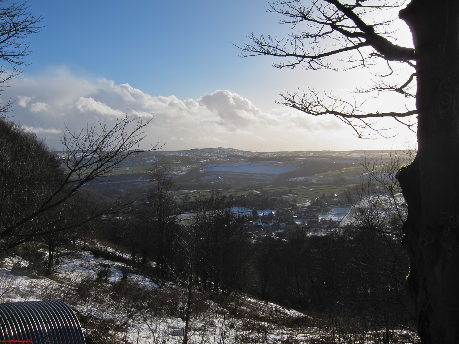
The gritstone edges of the Peak District are, in fact, a series of escarpments, the sheer gritstone walls towering above the valleys below. Make the effort to get on top of them though and they afford some great views…

Anyway, back to the walk. out of Grindleford Station we took the footpath up the inaptly named Tumbling Hill. I say inaptly as a) none of us tumbled and b) I’m not sure there was ever a chance of that on such a good path. Still I’m sure there is a story behind the name. From here it was a simple case of following Hay Wood to the A625, or at least that’s what Bob led us to believe…

Tumbling Hill

Just before the road there was the small matter of a stream to cross. Unfortunately, all the snow melt had turned this small stream into something much wider and faster and tricky to cross. Cue 5 walkers all staring forlornly at the water and poking at it with walking poles as we tried to find a place to cross. Eventually a place was found and a crossing fashioned but it came at a cost as I managed to lose a pole in the water. So 5 walkers safely over the water and dry but now down 1 pole. Grrrrrr… This is the stream (and I don’t think this photo does justice to the impressive flow of water) so if anyone finds a pole here it’s mine!

"The Stream"

From here cross the road and enjoy the views as you wander along Froggatt Edge. Eyam, Sir William Hill, Stanage and the Entrance to the Hope Valley…


Various view from Froggatt Edge

However, the reverie was soon to be broken...Here we were admiring this little waterfall / fast flowing stream off Froggatt Edge and those of us with cameras were maneuvering for a better view when Bob announced that the stream was actually the path! Now, in hindsight this shouldn’t be surprising as the water was following the line of least resistance and there was a lot of water. After much wailing and gnashing of teeth Bob stepped forward and led us down as we scrambled our way down staying just above the water. Not always easy to find the path at times but somehow we made it down with both dignity and dry feet...well, dry feet anyway… But, another surprise was in store as just before we reached the road to Froggatt Bridge we came across another new stream crossing the path. This one looked rather shallower though and after confirming that with my remaining pole I quickly forded across it and the others followed (this was probably the one moment in the day I was in front and not lagging behind - must get hill fitter as it is just too flat where I live).


2 views of the new "Froggatt Falls"

After a short break we walked up to Eyam where we settled down for lunch, the cookies I had brought (recipe to appear here soon) and erudite conversation (not really…). However, as we set off again we came to the plague cottages and started to read about how whole families living there had ended up dying and how scary and depressing it must have been for the dwindling number of people left behind. Indeed, when the plague came to Eyam in 1665 the North of England had been relatively unaffected so the whole village quarantined itself so as not to spread the disease even though it meant many villagers died. See http://www.eyamplaguevillage.co.uk for more information.

However sobering this moment we had to press on with the walk and from here it was an ascent up onto Eyam Edge via Beech Hurst and thence over Bole Hill and past what appears to be an old engine house from Ladywash Mine. A fluorspar mine it closed in 1979. From here we nipped down Sir William Hill Road before taking to Eyam Moor as we headed towards Leam. Now here was some proper snow. Most of it was probably about 12 inches or so deep but I was occasionally going into it up to my knees! The other snowmelt also seemed to be running under the snow as when your feet went all the way through the snow you found some really wet slippery ground. No photos here as the camera was safely in my pocket. One slip for me (and one for Sioban) but no damage done by the soft snow. Just one wet hand from some slushy stuff - thankfully it dried out without freezing my hand off!


Views back towards Eyam

From here we worked our way down to Leadmill Bridge and followed the River Derwent for a while before working our way up again. Thankfully not much up left at this point as we crossed under the railway, past Kettle House and through Rough Wood before ending up back at Grindleford Station just before it got dark.

View to Higger Tor and Over Owler Tor

All in all a great day with a fantastic bunch of eccentrics friends. 11.2 miles, 3,356 feet of climb, lost one pole and very stiff the next day. Great, great day though!


Tuesday, 24 July 2012

Ivinghoe Beacon video...

And, in what looks like the beginnings of a tradition, here is the video montage for your delectation...


Ivinghoe Beacon


A good forecast after all the rain we’ve had recently got me looking at the maps to plan a walk. The idea of walking over the Ivinghoe Beacon quickly seeded itself and a route was envisaged amongst a cornucopia of paths. All that was then needed was to go down there with my walking boots...


Starting at the car park at SP955149 (National Trust and free) Ivinghoe Beacon can be seen by crossing the road. However, that was to be the end of todays walk...I had decided to start by heading southwest along the Ridgeway.


View to the Ivinghoe Beacon from by the car park.


The Ridgeway runs between Overton Hill (Wiltshire) and the Ivinghoe Beacon (Buckinghamshire). Thought to be Britain's oldest road it dates back about 5000 years. Walking a route that has been trodden for so long feels quite humbling as you stand there with a view that stretches out for miles over the plains. These hills may not be the highest in the country, but, they punch above their weight in terms of vista to be admired. Very easy to linger round here…


Panoramic view

Tree on the first little hill


However, I was here to walk, so walk I did. Follow the Ridgeway over Pitstone Hill and down to Westland Farm. Enjoy the views all the way, whether they be the views off the escarpment, through gaps in the trees or even just the dappled light on the woody path. Once here it is on to the Herfordshire way, follow the path round past Church Farm into Aldbury.


The view back from Pitstone Hill
View from the woods

Grass

Aldbury Church


If you ever want to go and see a quintessential English country village then this is the place to go. I know it is a cliche to say “chocolate box image” but it is. Swap the modern cars for a few Morris Minors and this could be a scene from the 1950’s...


Aldbury


From here though you have to climb as you head up the hill towards the Bridgewater monument. A word of caution here - as you climb the hill  you come to a V-junction in the path. The OS map makes it look as if the monument is on the lower path...it isn’t, it is on the higher one! Head for the NT symbol. Signs like this one don’t help either. Yes, I know I need to keep going but...


Which way???


The Monument itself was built on the Ashridge Estate in 1832 in memory of Francis Egerton, 3rd Duke of Bridgewater (1736–1803), "the father of inland navigation". So called as he was the commissioner of the Bridgewater Canal, arguably the first true canal in Britain and the modern world. It is 108 feet (33 m) tall, with 170 steps inside. You can climb to the top and look out towards Ashridge House. I didn’t do this today as it was absolutely heaving with people here as it is part of the National Trust and it was a gloriously good day. More disappointingly though the cafe was packed as well - no tea and cake for me! Still, probably better for the waist line!!


Bridgewater Monument


One final note - the Monument was built away from Ashridge House as his mother wanted "not to see or be reminded of my infernal son". Family eh...


From here though it is time to enter the woods as you follow the tracks past Sallow Copse. This was the point where I was really glad I had put proper walking boots on. I’d been debating trail shoes earlier on but choose boots given all the rain recently. At first the paths had been very dry, occasional muddy patch in the shade of the trees but nothing that couldn’t be side stepped. Here though it was proper mud with my feet sinking deeply enough into the brown stuff that I’d have had wet feet in shoes. I have to say as well that these woodland tracks weren’t always brilliantly marked and there was a definite detour into the car park at SP981143 with the marked footpaths on the map not always visible on the ground.


Entering the woods


From here on though the going improved again. Follow the path around the reservoir and in front of Ringshall Coppice. Here was a an interesting broken bough (maybe even a whole tree) and some very nice fields in which to linger for lunch. Whilst here came across the cutest Westie in the world. Being walked by his owner, with whom I had exchanged a few pleasantries about the weather, he just sat there and wouldn’t go past. Thinking he might be scared of the big strange man I took a few steps back off the path and crouched down, but, he still just stood there refusing to go despite the owner calling and encouraging him. Eventually we realized he was scared of my rucksack! As soon as I moved it he raced past to his owner. Awwww!


Broken boughs

Grass and Sky


Anyway I digress. Continue along this path past Ward’s Hurst Farm and then through The Coombe as you pick up the Icknield Way Trail. This runs from the Ivinghoe Beacon (Buckinghamshire) to Knettishall Heath (Suffolk) and is another of Britain's most ancient Trackways. Along with the Ridgeway it forms part of the Greater Ridgeway. A 583 kilometre long distance footpath crossing England from Lyme Regis (Dorset) to Hunstanton (Norfolk). This is made up of four long distance footpaths - the Wessex Ridgeway, The Ridgeway National Trail, the Icknield Way and the Peddars Way National Trail.


Sheep on the Farm


However, rather than follow it directly to Ivinghoe Beacon I decided to take a little detour. As you come out of The Coombe turn right and follow the footpath along the fields and up to Gallows Hill. This give you some lovely views up to Beacon Hill and towards the White Lion.  Created in 1933 it is on the slope beneath Whipsnade Wildlife Park which it effectively advertises.


Whipsnade White Lion

Path back down the hill

Fields, Hills and Sky


From here just follow the ridge (and enjoy the cooling breeze) as you walk up to Ivinghoe Beacon itself. Only 233m (757 feet) above sea level it nevertheless provides a sumptuous vista and is rightly popular with all the people and families who were there enjoying the view. 


View from Ivinghoe Beacon

Another view from Ivinghoe Beacon
From here the end is also in sight as we step back onto the Ridgeway and follow it over Steps Hill and around Incombe Hole to the car park.


Look down into Incombe Hole

Look back at the path around Incombe Hole


All in all a great walk on a great day. I shall have to go back again some other day...